Using Rail and Bus for Everyday Travel
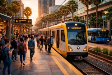
Connecting Long Beach to the broader Los Angeles County rail network, the Metro A Line runs through nine stations within the city, from Artesia in the north to Downtown Long Beach at its southern terminus.
Metro A Line Stations
Riders heading downtown most often board at Downtown Long Beach, 1st Street, or 5th Street. Pacific Avenue, Anaheim Street, and Willow Street serve mid-city corridors, while Wardlow, Del Amo, and Artesia link northern neighborhoods to Compton and beyond.
Long Beach Transit Bus Network
Rail doesn't reach everywhere. Long Beach Transit fills that gap with routes covering neighborhoods the A Line misses entirely. Buses tend to run every 15 to 30 minutes on core corridors. Fares are $1.25 per ride, and TAP cards work across both systems, simplifying transfers considerably.
Downtown and Waterfront Trips Made Easier
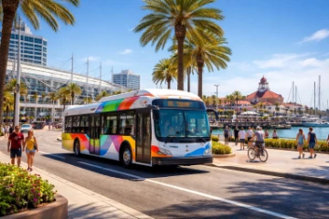
For short hops around the waterfront, standard bus routes often feel like overkill. Two services fill that gap well.
The Passport Shuttle
Long Beach Transit's free Passport shuttle runs through downtown, connecting the Convention Center, Shoreline Village, Pine Avenue, and the Transit Gallery. Routes A and B cover most visitor-heavy corridors, and frequency is reasonable enough that waiting rarely becomes a problem. For anyone moving between the Aquarium and a downtown restaurant, it beats hunting for parking.
AquaLink and AquaBus Water Taxis
Operated seasonally by Long Beach Transit, the AquaLink connects Shoreline Village to Alamitos Bay Landing and Rainbow Harbor. The AquaBus runs shorter hops within the harbor area. Fares are modest. Neither service is built for commuters – schedules are limited and weather-dependent – but as a scenic way to cross the waterfront, there's no denying they offer something a bus simply can't.
Bikes and Flights Round Out the Network
Long Beach has a genuine cycling culture, and the infrastructure mostly backs it up. Protected lanes run along several corridors, with 2nd Street and the beach path among the more comfortable options for riders.
Cycling Realities
Busy intersections near downtown and the port area demand more attention. Route choice matters considerably here. Sticking to marked bike lanes reduces exposure to heavy traffic, and the city's bike map is worth downloading before heading out.
Bike Share for Last-Mile Gaps
Metro Bike Share stations near the A Line's Downtown Long Beach and Willow stations give rail riders a practical option for covering that final stretch to the beach or into surrounding neighborhoods.
Long Beach Airport
Sitting roughly three miles northeast of downtown, Long Beach Airport is small enough that check-in lines rarely punish late arrivals. Rideshare and taxi access is straightforward. Parking fills quickly on Monday mornings, so transit via Long Beach Transit Route 111 is a reasonable alternative for travelers without heavy luggage.
The Best Way Around Depends on the Trip
Rail makes sense when the destination is downtown Los Angeles or a Metro-connected neighborhood – the A Line handles that efficiently without the freeway stress. For local errands across Long Beach itself, bus routes fill the gaps the train can't reach, while the Passport shuttle keeps downtown circulation simple and free. Bikes work well for short, flexible trips where parking would otherwise eat up time. The AquaLink and AquaBus connect the waterfront in a way no bus route quite replicates. Long Beach Airport, compact and unhurried, suits local travelers who'd rather skip the LAX ordeal. Matching the right mode to the actual trip – rather than defaulting to a car – saves time, cuts parking costs, and opens up parts of the city that a windshield view tends to miss.